


On the afternoon of July 8, a Binh Thanh Commune official confirmed a severe weather event. Specifically, a massive tornado had just swept through Quang Hung and Cao Mai villages.
Fortunately, the disaster caused no human casualties. However, the fierce winds still knocked down many trees and completely ripped roofs off several homes.
Prior to this, numerous terrifying videos circulated widely on social media. These clips captured a massive tornado column rising hundreds of meters high.
Moreover, the column stretched directly from pitch-black storm clouds down to the ground. Within a few fleeting minutes, the vortex spun continuously with violent force. As a result, it swept a massive amount of dirt and debris high into the air.

Close-up view of the towering tornado
According to the National Center for Hydro-Meteorological Forecasting, the northern region of Vietnam was heavily impacted by a low-pressure trough on July 8, with its axis passing directly through the area. The regions of Quang Ninh, Hai Phong, and the coastal areas of Hung Yen and Ninh Binh fell under the influence of this low-pressure trough and a low-pressure vortex situated right over northern Vietnam. This volatile system formed a dense, heavy pocket of convective clouds directly over the eastern coast of the northern region.
Strong convective zones developed rapidly within this area. The tornado phenomenon in the Hung Yen coastal region (historically part of the old Thai Binh maritime zone) formed right inside the convective zone created by this low-pressure trough. In its official forecasting and warning bulletins, the Center had previously issued alerts regarding thunderstorms, heavy rain, and squalls along the nearshore waters of the Gulf of Tonkin, explicitly warning of the potential for tornadoes, strong wind gusts, and large waves.
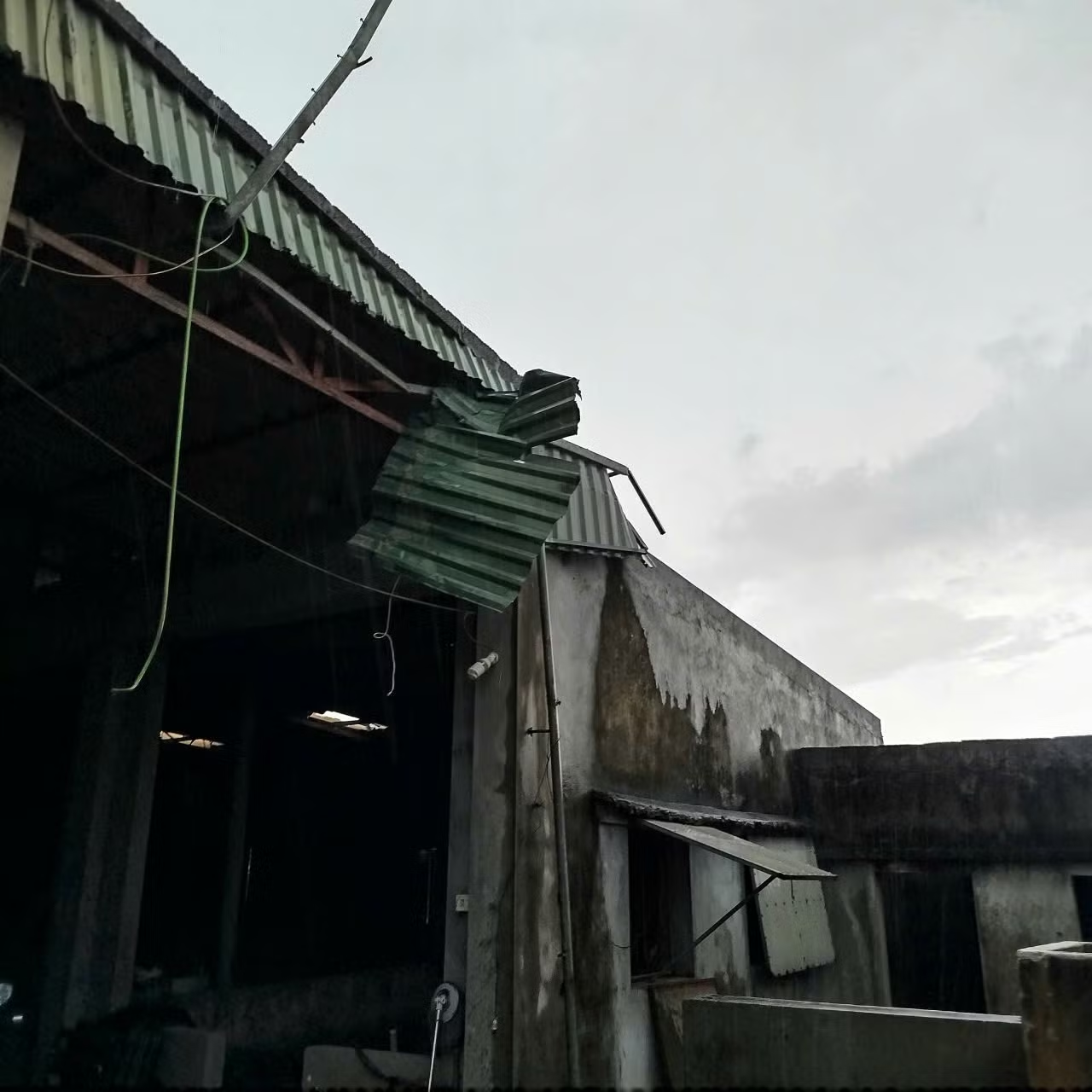
Corrugated iron roofs of local homes in Binh Thanh Commune damaged after the tornado tore through the area. Photo: Nhan Vu/Dan Tri Newspaper
The dangerous weather forecast indicates that this system will linger. From now through the end of July 11, the low-pressure trough passing through northern Vietnam will remain highly active. It will continue to unleash widespread moderate-to-heavy rainfall across the northern midlands, mountainous areas, and Quang Ninh Province. Over the next two days, the Gulf of Tonkin will also experience severe thunderstorms, and authorities urge everyone to remain vigilant against the imminent threat of sudden gales, tornadoes, and violent wind gusts.
Discover more from Vietnam Insider
Subscribe to get the latest posts sent to your email.