

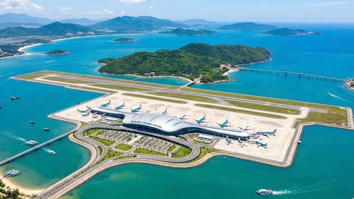
Planners have proposed building Van Phong Airport in Van Thang Commune, Khanh Hoa Province. Consequently, the site sits roughly 65 kilometers from Nha Trang city center. In addition, it lies approximately 108 kilometers north of Cam Ranh International Airport and 48 kilometers south of Tuy Hoa Airport.

Proposed location of Van Phong Airport according to the master plan project. Photo: QHQG
The designated planning zone occupies roughly 497.1 hectares of nearshore coastal waters. Notably, the location contains no residential dwellings or protected mangrove forests. Furthermore, authorities have designated no boat anchorage zones across the water surface.
Under ICAO classification, planners designed the facility as a 4E-grade airfield. Therefore, it will handle approximately 1.5 million passengers annually by 2030. Capacity will reach 2.5 million passengers per year by 2050. Meanwhile, projected total investment stands at roughly 9.214 trillion VND.

Proposed construction site of Van Phong Airport viewed from the south. Photo: Ba Duy

Aquaculture dyke promontory jutting out to the south of the planned airport. Photo: Ba Duy
The project aims to establish an essential aviation gateway serving the South Central Coast and Central Highlands. Consequently, it strengthens connectivity with the Van Phong Economic Zone. Furthermore, the hub will accelerate tourism, regional logistics, socio-economic progress, and foreign trade integration.
According to Khanh Hoa provincial authorities, the initiative aligns with the Van Phong Economic Zone Master Plan toward 2040, with a vision to 2050. Moreover, it adheres to previously approved land-use zoning frameworks.

A concrete coastal sea embankment lies to the south of the planned airport site. Photo: Ky Nam

Van Thang fishing port situated south of the airport planning area. Photo: Ky Nam
Coastal Waters Rather Than an Artificial Island
The standout characteristic of the proposal lies in its construction across nearshore shallow waters. Because of this layout, observers describe it as Vietnam’s first offshore airport. In reality, the site utilizes nearshore intertidal water surfaces rather than an isolated artificial island far at sea.

The existing tidal creek, locally called the Goc River, flows into Van Phong Bay directly beside the proposed airport site. Photo: Ba Duy

The surrounding area currently consists of private aquaculture ponds. Photo: Ba Duy

Existing rice fields and residential settlements border the southwestern perimeter. Photo: Ba Duy

A few hundred meters inland from the sea lie ponds, orchards, homes, and Nguyen Hue Street. Photo: Ba Duy

Diep Son Island visible across the bay, situated near the proposed coastal airfield. Photo: Ba Duy
Globally, water-based airport designs operate across land-scarce economies. For instance, Japan’s Kansai International Airport operates entirely on an artificial island built inside Osaka Bay.
If greenlit, Van Phong Airport will introduce a strategic aviation terminal to Vietnam’s regional transit network. As a result, it will unlock substantial infrastructure potential for Khanh Hoa Province and the surrounding South Central Coast.
(Source: thanhnien.vn)
Discover more from Vietnam Insider
Subscribe to get the latest posts sent to your email.